Lx Super Res
Bring AI-powered super-resolution to your satellite imagery
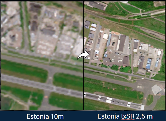
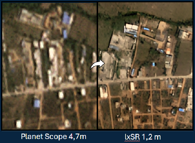
Lx Super Res is LuxCarta’s plug-and-play super-resolution solution that enhances satellite imagery by a factor of 4, delivering sharper, more detailed data at a fraction of the traditional processing costs.
Why Lx Super Res?
Lx Super Res uses advanced AI to instantly upscale your satellite data, turning medium-resolution imagery into crisp, detailed visuals. Whether for urban mapping, environmental monitoring, or simulation projects, Lx Super Res unlocks the full potential of your geospatial datasets.
-
-
-
Sharper Insights – Reveal hidden details from imagery between 10m and 50cm resolution.
-
Cost-Efficient Processing – Boost clarity without the expense of new acquisitions.
-
Scalable Workflow – Process single tiles or large-scale datasets with predictable performance.
-
Seamless Integration – Works with your existing GIS, CAD, and visualization tools.
-
-


Key Features
|
AI-Powered Super-Resolution Transforms imagery by a factor of x4, revealing sharp, actionable data from medium-resolution inputs. |
Compatible with Multiple Sensors Works with data from Sentinel-2, Pleiades, and other satellites (10m to 50cm). |
|
Flexible Deployment Run on LuxCarta’s production environment or integrate on-premises for total data control. |
Easy Integration & Control Delivers clean, standardized outputs for mapping, planning, and analysis. |
Lx Super Res
Turn standard satellite images into ultra-clear, high-resolution data
Turn standard satellite images into ultra-clear, high-resolution data
Lx Super Res enhances satellite imagery by a factor of 4, transforming medium-resolution inputs into sharp, detailed visuals. Designed for mapping, urban planning, and environmental monitoring, it delivers clearer, actionable data at a fraction of the cost of traditional methods, all seamlessly integrated into your existing workflows.
